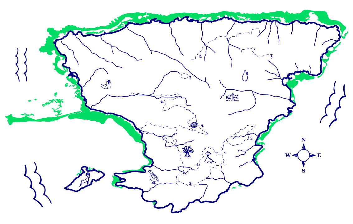
Welcome to Aegina's seagrass map, created to show you some of the natural wonders of our island.
Seagrass
Aegina is surrounded by seagrass meadows. Why is this important enough to put on your table?
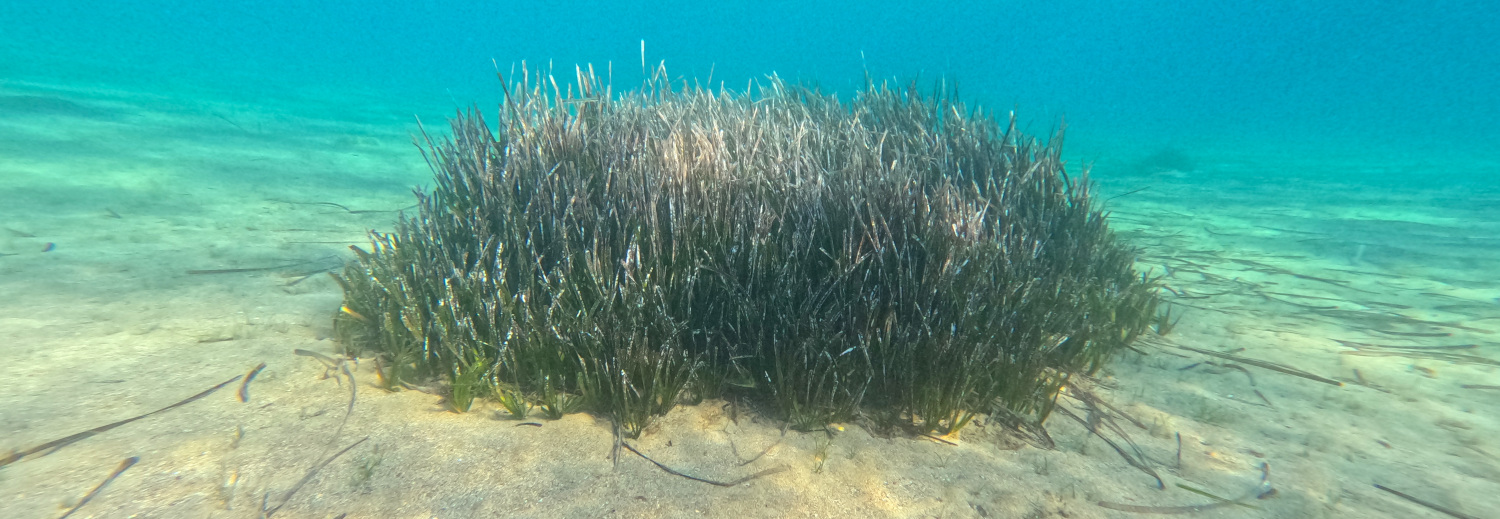
Seagrass meadows turn the barren seafloor into a rich habitat for other life, making a home for all the fish, octopuses, cuttlefish, and other creatures which live around Aegina. They’re also important for the whole planet, storing more than ten percent of all the carbon in the oceans, and making most of the oxygen found in coastal waters. Per hectare, seagrass meadows draw down fifteen times as much carbon dioxide as rainforests. When the leaves wash up on the beaches, they stabilise the shoreline, preventing erosion and soil loss.
Seagrasses grow all around the world, in depths from one to thirty-five metres. Our local seagrass is Posidonia oceanica: this is the plant which can be seen all around Aegina, as dark patches of green on the sea floor, and piles of sandy leaves washed up on the beaches.
Seagrasses are easily damaged and destroyed. In the last fifty years, we’ve lost half the world’s seagrass meadows, due to ocean warming, pollution, noise, fish farming, trawling, and ship’s anchors. But we can all help to preserve, protect, and regrow these meadows.
How can you help?
- Read more about Posidonia oceanica
- Anchor boats safely
- Find out more about the Greek Seagrass Alliance
- Support Aegean Rebreath, an organisation working to protect our ocean
Hiking
The map also features Aegina's hiking paths, a network of ten trails through which you can discover the island. Away from the beaches, Aegina offers a range of spectacular walks to ancient churches, through forests and olive groves, and around Mount Ellanion, revealing its natural beauty and precious history.
Remember to wear good shoes, carry water, and in the summer, stick to the mornings and evenings. It’s hot out there!
→ Find out more at aegina-hiking.com
Rivers
The map also shows the watercourses of the island - many of which only flow, if at all, for a few days of the year. But in some ancient myths, Aegina was a river nymph - one of the daughters of Asopos, a King of Boetia.
Aegina is one of the driest places in Greece, thanks to its unique location in the Saronic Gulf. But these rivers are vital to our landscape, and our future. They channel flood waters away from homes and fields, and allow the rain to soak into the ground. By protecting and preserving these watercourses, we can ensure that Aegina stays green, fertile - and safe - for future generations.
What else is on the map?







How did we make this?
This map was made using satellite data gathered and analysed by Greek researchers, and by our own observations swimming and flying a drone aroud the coast of Aegina.
We are very grateful for this data, which is made available to the public under a Creative Commons license:
Panayotidis Panayiotis, Papathanasiou Vasillis, Gerakaris Vasilis, Fakiris Elias, Orfanidis Sotiris, Papatheodorou Georgios, Kosmidou Maria, Georgiou Nikos, Drakopoulou Paraskevi, Loukaidi Vasiliki (2022).
Seagrass Meadows in The Greek Seas. SEANOE. https://doi.org/10.17882/87740
Seagrass meadows in the Greek Seas: presence, abundance and spatial distribution. Botanica Marina, 65 (4). https://doi.org/10.1515/bot-2022-0011
Special thanks to Dimitris Poursanidis at the Remote Sensing lab of the Institute of Applied and Computational Mathematics, FORTH, for their advice on this project.
Who made this?
We’re Vessel, an artist collective founded on Aegina in 2021. We make work about and for the island, and run events and workshops, in support of sustainable and regenerative futures.
This map was produced as part of TIDAL ArtS Lighthouse Projects, a Horizon EU funded programme. As well as creating this tablecloth, we’ve been surveying the islands meadows, and working with scientists to better understand and protect them.
We also use seagrass for sustainable architecture, making paper, and dyeing clothes. We work with local schools to educate children about the environment, and explore the watery history of the island.